

|
|
|
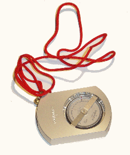
Magnetic compass
 This is the basic tool of navigation and orienteering in the forest. Usually the compass reads in degrees with a full circle measuring 360 degrees. Some prefer a compass that reads in quadrants but the most common is in degrees. A compass bearing of 0 degrees is consistent with a bearing due north and a bearing of 180 degrees is due south. Oil filled compasses with a sighting reticle are considered minimum for a decent forestry or orienteering instrument. The oil in the compass keeps the needle steady enough to maintain readings in the one degree range. The sighting reticle allows the accurate placing of a bearing onto a specific ground feature.
Increment borer
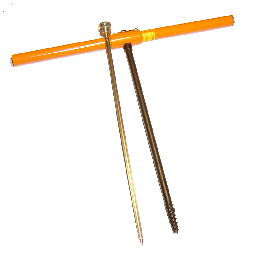 Knowing the age and the growth pattern of a tree can be measured using the increment borer. The borer is pushed onto the edge of the tree a breast height and screwed into the tree with the handle similar to any screw. The center of the borer bit is hollow and the screwing action forces a tube of tree pulp into the center of the borer. It is removed from the corer with the extractor. The core yield information by revealing the ring history of the tree. Each year the tree produces another ring with the winter portion of the yearly growth being darker than the spring growth. By counting the rings it is possible to determine the age of the tree. Further information is yielded by the size of the rings since a larger spacing between years would mean a better growth rate for the tree.
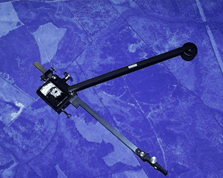
The Clinometer
The clinometer is an instrument which will measure the height of the object without necessitating a climb to the top. The user can measure the height of trees or the heights of mountains. Clinometers are used by taking a measurement of the angle above or below the horizontal. The scales may read in percent, feet or meters. The clinometers used by foresters most commonly use "topo" scales and percent scales. Topo scales require the user to sight from a distance of 66 feet and the clinometer reads in feet above or below horizontal. The percent scale reads as a percentage of the distance the user is standing from the subject that is being measured. Hence a user standing 100' from the subject and measuring 35% on the scale would be reading 35' above the horizontal. Compensating polar planimeter
This device reads area usually in square inches from a plane surface. For foresters this translates to reading square inches from aerial photographs. Using the scale of the photo and the area in square inches read from the planimeter allows the forester to calculate the acres in different forest types. Aerial photo
Aerial photos are quite often available at the tax assessor's office in the county in which the property resides. The experienced forester can gain information about the properties ground cover and gain a good guide to orienteering in the field. To achieve maximum utility a scale is valuable. The USGS aerials are available on the internet at: http://terraserver.microsoft.com/ Plat of Survey
Very few properties don't have a plat of some sort. A recent survey can be helpful both in providing a good description of the boundaries and hopefully the boundaries of the property were marked at the same time avoiding the confusion of trespassing onto another's property Topographic map
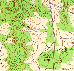
Topographic maps are available from the United States Geological Service (USGS) and are available on the internet at: Topographic maps provide ground slopes and altitudes as well as geographic terrain features useful in orienteering. Tape measure
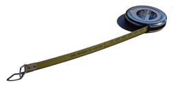 One of the most important measurements to the forester is the diameter at breast height of a tree most often abbreviated as DBH. This measure along with the trees height is used to calculate the amount and type of usable wood in the tree. Trying to measure the diameter of a tree can be done with large calipers but it is best to measure the tree with a tape measure around the circumference of the tree. The circumference in inches must be converted to diameter by dividing by pi (approximately 3.14.) The easier alternative is to purchase a tape that reads diameter directly from a circumference and is readily available at forestry suppliers.
Marking tape
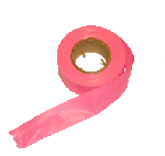 Plastic marking tape is usually luminescent for high visibility. It separates easily and is highly flexible. It is used to delineate areas, particularly survey boundaries and sample areas.
GPS (Global Positioning System)
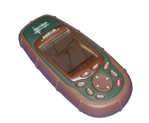 Knowing where you are at all times is a critical part of making accurate forestry maps and estimating timber volumes. The GPS can be programmed either to tell you exactly where you are and can create a trail of exactly where you have been. It can also be used as a guide to specific points on the parcel of property. These characteristics make it beneficial for establishing sample points, finding boundaries, or marking the location of specific features.
Pace
This tool is inherent in the forester but provides a quick measure for delineating sample plots and orienteering. To make this a useful tool you must first know the measure of your pace. To measure your pace, simply count your paces for a known distance and convert to paces per 100 feet. For me its 39 normal steps per 100 feet but yours can be substantially different. If you can't find forestry tools locally, you might try some of the mail order suppliers. We have used these with good success. |

